Results 1 to 6 of 6

Thread: Turbulence over mountains and canyons

  1. Header
  2. Header-68

BLiNC Magazine, always served unfiltered
  1. #1

    Turbulence over mountains and canyons

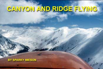
    Canyon and Ridge Flying
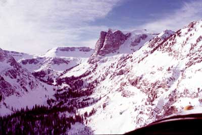
    Mountain Flying


    Mountain Flying is defined as that type of flight that involves maneuvering in areas exhibiting steep or precipitous terrain, without regard to the elevation of that terrain. The terrain may only be 1,000 feet above sea level. But if it is abrupt or sheer terrain, it qualifies as mountain flying.
    The term "mountain flying" often is called "contour, drainage or terrain flying."
    Mountain flying may involve flying through the mountains where the surrounding terrain is higher than the airplane.
    It is also acceptable to describe mountain flying in terms of flying over the mountains. In this case the pilot selects an altitude 2,000 feet above the highest terrain within about 5-statute miles of his course.
    Regardless of whether you are flying with the mountains or over the mountains, the basic premise of all mountain flying applies: "Always remain in a position where you can turn to lowering terrain."

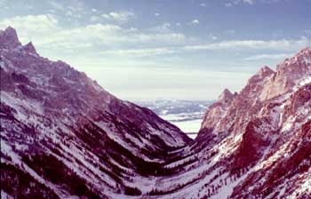
    Flying Canyons


    Recalling an afternoon flight from Billings, Mont. to Jackson, Wyo. during the fall of 1968, I found myself, as a novice pilot, positioning my airplane in the middle of canyons for what I considered good reason ... staying away from those scary old canyon walls. This is when I first discovered that flying in the center of a canyon places the airplane in a poor position to turn around and backtrack to avoid some scattered thunderstorms passing through the canyon area.
    I later learned there are two compelling reasons to avoid flying the center of the canyon. First, there is only half the canyon width available for a turnaround maneuver if the canyon narrows, the terrain begins to out climb the airplane, or if the weather provides an impelling reason to skedaddle the area.


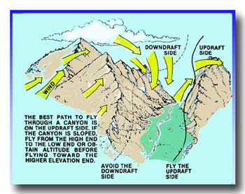
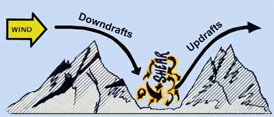
    Second, the center of a canyon is the area where shear will b e found. Air flowing down the lee side and up the windward side of a canyon creates turbulence.
    Fly the side of a canyon to allow for a turnaround maneuver.
    Depending on the stability of the air, or lack of stability, there is often found an area that lacks any type of a meteorological emulsifier to mix the air; rather, the air sets up an eddy current that creates shear.
    If you have a choice when flying through a canyon, fly the upwind side. It provides a better ride and there in no-compromise with aircraft performance degradation due to downdraft s and turbulence.
    Canyon flying can be broken down into three broad classifications: the wide canyon, the narrow canyon and the downslope canyon.
    Wide Canyon with Level Terrain
    This canyon does not pose a problem for flight. Still, to avoid the possibility of shear, the flight path should be along one side. How close you fly to the side depends on the circumstances and stability of the air. If you are trying to take advantage of potential lift, you will find 500 feet from the canyon side is an acceptable distance. Occasionally, to take advantage of any uplifting air it will be necessary to move closer to the canyon walls.
    Narrow, Upslope Canyon


    The narrow canyon is defined as being of a width that if a turnaround is required, the airplane will use more than one-half of the canyon width.
    Radius of turn is defined as being from the center of a circle to the outside edge. This often creates confusion for the novice pilot who thinks he can turn around within the computed value of the radius of turn. The airplane begins its turnaround on the outer edge of a circle. It is necessary to double the value of the radius to determine the width of the turnaround.
    Turn around and gain additional altitude
    before the terrain out climbs the airplane
    or the canyon narrows to prevent a turn.
    For normal flight through a canyon, even one with upslope terrain, the flight is generally made on the side with the updraft.
    Flying up a narrow canyon is different; it should be accomplished by flying on the downwind side. This way, if you get into trouble and need to reverse course, you are not turning into a worse situation,. Flying in a narrow canyon along the updraft side will cause the airplane to penetrate into the downdraft side during a turnaround maneuver.
    Downslope Canyon


    Normally the downslope canyon can be flown on either the updraft side or the downdraft side. Since terrain clearance is not a concern, if you get in a downdraft and feel uncomfortable, move to the other side.
    Canyon Turnaround
    I had a student who was introduced to flight by a buddy while in the military (you will be hard pressed to find better pilots than the ones trained by the military).
    John, in response to my ground school question about a canyon turnaround, told me in all seriousness that if he was ever "trapped" in a canyon he would do a hammerhead stall to get out.
    There are a couple of problems with his idea. Generally by the time a pilot realizes he is in trouble, the airspeed is too slow to perform a hammerhead stall or a hammerhead turn. The second problem, even with sufficient airspeed, most of us do not fly aerobatic airplanes in the mountains.
    The proper procedure to reverse course is to use the steepest bank you are comfortable flying at the slowest speed possible.
    Speed is important. Go outside and draw a six-inch circle on the ground. Place your feet within this circle (as much as possible), and turn around slowly. You can complete a 360-degree turn without your feet leaving the circle. Next, while walking about two miles per hour, try to keep your feet within the circle. Not possible. As your speed increases, the radius of turn increases. The same thing happens to the airplane. The faster the airplane is flown at any given bank, the larger the radius of turn.
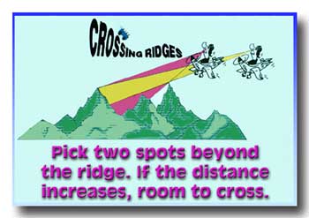
    Crossing Ridges


    Without experience the visual aspects of determining whether you are higher than an approaching ridge can be deceiving. The spot method works well to determine your altitude (the spot method is not covered in this article).
    As you approach a ridge, turn to a 45-degree angle to allow a safe retreat if you encounter downdrafts or turbulence. This recommendation does not suggest that if you fly perpendicular to the ridge and need to reverse course that you will not be able to do so. The main reason for the 45-degree approach is to ease the forces on the airplane.
    This recommendation does not suggest that if you fly perpendicular to the ridge and need to reverse course that you will not be able to do so. The main reason for the 45-degree approach is to ease the forces on the airplane.
    If you approach a ridge "head-on" and need to reverse course, during a 60-degree bank the airplane experiences a 2-G load factor. Turbulence can add to the load factor where it can exceed the normal category limits. The 45-degree angle approach allows a turn to lower terrain with less bank angle and less force on the airplane.
    When you want to know whether or not you have sufficient altitude to cross a ridge, determine ridge clearance with the "spot method for landing."
    I used to teach students to pick an arbitrary point near the top of the terrain on the other side of the ridge. Then they looked for the lowest point they could see on the other side of the ridgeline. As the airplane approaches the ridge, if the distance between the two points is increasing, the airplane is higher than the ridge and the flight can most likely continue.
    I found this method does not work well with students. The students becomes so involved with watching the points that they develop "tunnel vision," where they are not aware of anything else that's going on with or around the airplane.
    To determine if it is safe to cross a ridge, continue (you are flying at a 45-degree angle that allows an easy escape) until you are at a point where, if the power is reduced to idle, the airplane will glide to the top of the ridgeline. It is not proper technique to reduce the power when crossing ridges, this is just your "measuring stick" to make sure you are crossing with safety. As this point you can turn the airplane to any heading and cross the ridge.
    If the airplane has arrived at the point where it can glide to the top of the ridgeline without experiencing a downdraft, it is now positioned so that even if a downdraft is encountered, the performance is such that by lowering the nose slightly to maintain the airspeed, the airplane can safely cross the ridge.
    Blue skies and safe flying.

  2. #2

    Re: Turbulence over mountains and canyons

    The Truth About Airplane Turbulence
    Rough air injured more than two dozen airline passengers this week, but that's just one unavoidable risk you take while flying. Or is it? Our primer explains the three kinds of airplane turbulence, and what you can do to stay safe on a plane.
    By Michael Belfiore
    Comments
    Share
    August 7, 2009 4:54 PM

    Name:  turbulence-470-0809.jpg
Views: 1753
Size:  36.7 KB
    Turbulence research
    (Photograph courtesy of NASA Langley Research Center)

    It's an unpleasant but familiar experience: You're cruising along at 30,000 feet when turbulence seems to yank the airplane out from under you. If you're like some of the 26 injured passengers on Continental Airlines Flight 128 last Monday (or the two people on Delta Airlines Flight 2871 last Tuesday) and you're not buckled in when this happens, you could meet the ceiling with unpleasant results.

    The Federal Aviation Administration says 58 airliner passengers are injured every year by turbulence. In fact, turbulence is the number one cause of injuries to passengers and flight attendants in nonfatal accidents. Two-thirds of those injuries happen above 30,000 feet—just when you're told you can get up and move about the cabin. We checked in with Virgin America chief pilot Rob Bendall to find out what causes turbulence and what, if anything, pilots and passengers can do to avoid the worst of its effects. There are three kinds of turbulence:

    1. Turbulence during storms
    Name:  turbulence-storms-0809.jpg
Views: 1731
Size:  23.5 KB
    Turbulence during storms

    Convective weather patterns, i.e., thunderstorms, represent the only form of turbulence that pilots, and the meteorologists who back them up, can actually see. Strong updrafts and downdrafts in the heart of a storm can shove an airplane up or down as much as 6,000 feet. "You can't go through them, you've got to go around them." Bendall says of thunderstorms. "That's just the rules of the road." While the worst turbulence occurs in the middle of a storm—typically between 12,000 to 20,000 feet—storms and the turbulence they create can rise as high as 50,000 feet, well above the 30,000 to 40,000-foot ceiling of most airliners. Fortunately, weather forecasts, radar, and updates from the ground and other aircraft can help pilots steer clear of the worst weather. But rough air is not the most dangerous element of flying through a thunderstorm. Storms bring other dangers, such as lightning and hail that can break cockpit windows or damage engines.

    2. Turbulence over mountains
    Name:  turbulence-wind-0809.jpg
Views: 1681
Size:  10.6 KB
    Turbulence over mountains

    When strong winds blow perpendicular to mountain ranges, air flowing over the top of a mountain produces turbulence in the form of waves when it reaches the other side, just as ocean waves break on the lee side of a submerged reef. Although they can't see the turbulence itself, pilots can anticipate so-called "mountain waves" as they fly over mountains because they are so common there. A further tipoff when conditions are right for mountain waves is the presence of lens-shaped lenticular clouds in the vicinity.

    3. Unexpected turbulence
    Name:  turbulence-jetstreams-0809.jpg
Views: 1713
Size:  26.4 KB
    Unexpected turbulence

    The most insidious kind of turbulence, clear-air turbulence, is invisible, comes without warning and occurs any time during a flight. One of the main culprits of clear-air turbulence is the boundary between the jet stream—that aerial river that forms where arctic air masses meet warmer air from the south—and the slower-moving air adjacent to it. This invisible boundary shifts unpredictably, and woe to any unstrapped passenger in a jet that crosses it. "If you're flying in clear air, you have no indication at all," Bendall says. If an aircraft has passed through the area ahead of your airplane, your pilot might get an advance warning of turbulence ahead. "But if you're an early morning flight and you're going through an area first, you're going to be 'Probe One.'"

    Even the worst turbulence is no cause for alarm—by itself. "I don't think an airplane has ever broken up in flight because of turbulence," Bendall says. "These airplanes are built for so much more than even a severe [turbulent] event."

    Which makes passenger safety when an airplane hits turbulence—especially without warning—primarily the responsibility of the passengers themselves. That means buckling your seatbelt, just as the pilots and stewardesses recommend, anytime you're seated. Bendall advises air travelers not to get complacent. "The best thing to do is to not loiter around in the aisles of the airplane," he says. "Do what you need to do, then get back to your seat and put on your seatbelt. You're still hurdling through the air at 500 miles an hour; things can happen."

  3. #3

    Mountain and Canyon meteorology

    Wings Seminars Oct 10, 2009:
    Mountain and Canyon meteorology
    With
    Amy L. Hoover

    This seminar addresses some general meteorological phenomena that you might encounter when flying in any mountainous area. Specifically we will investigate phenomena that are unique to mountainous areas where there are deep river canyons and associated local winds and weather patterns.
    Before any flight it is always a good idea to get a normal FSS weather briefing to give you an idea of position and movement of major fronts, precipitation, convective activity, winds aloft, and aviation weather reports. Television and Internet weather services are also a good source of information, but keep in mind that weather in mountainous areas can change rapidly, and forecasts may not be valid past a few hours. In the summer months major weather concerns will be morning fog in valleys and canyons, wind, and evening thunderstorm activity. Wind and weather can change rapidly and vary greatly from one location to another that is only a few miles away. In some areas you may be able to obtain a backcountry radio report from remote Forest Service facilities or private ranches, which are a good source of weather information. Additionally, it will be important to talk to other pilots about fog, surface wind conditions, and convective activity unique to a certain area.

    Winds and Mountain Waves
    When wind blows in the mountains it creates wind shear, lift, sink, and turbulence. It is prudent to maintain a constant awareness of wind direction and strength. You can get an idea of local wind is by looking at trees, smoke, and mountain lakes. Cloud shadows can give an indication of the prevailing wind at the level of the cloud layer. Always be alert because wind speed and direction can change constantly and are not consistent, even from one ridge or canyon to the next.
    When winds aloft blow more than 25 knots perpendicular to a mountain range such as the Cascades or Sierra Nevada, they may produce the classic mountain wave effect. Wind may be fairly calm on the windward side, but turbulent on the leeward side with rotors and downdrafts. The actual waves may extend for miles downwind of the mountain range, and wavelengths can vary, but generally are about eight to ten miles. The shorter the wavelength the greater the amplitude of the wave. Cap clouds, rotor clouds, and standing lenticular clouds may form if the air has enough moisture. When you suspect any mountain wave activity you should use extreme caution. Keep in mind that forecast high velocity winds aloft, cirrus clouds, and lenticular clouds all indicate increased wind flow over the mountains.
    Wind velocity increases as wind crosses any ridge, and you could encounter large downdrafts on the lee side of ridges, sometimes without much turbulence. Use extreme caution when crossing ridges, and always do so at the recommended 45 angle so that you can turn away if you encounter downdrafts. In narrow mountain passes you may encounter an increase in wind speed called a "venturi effect", even when the prevailing wind is only light to moderate. Venturi effects are discussed later in this section.
    Knowing the winds on the ground is critical when operating in and out of mountain and canyon airstrips. In the summer, many of the strips in mountainous areas, and especially in canyons, are unsafe to fly into or out of by late morning because of wind. Landing with a good headwind at a one-way strip means you would be departing with a tailwind. This subject will be covered in more detail in the section on landing operations. Generally, if there is wind you should consider returning to land later when there is no wind, or plan to stay at a one-way strip until the wind decreases.

    General circulation and pressure patterns
    In the northwestern USA, where there is a lot of mountainous terrain, atmospheric circulation is generally from the west or southwest, which has an effect on weather and wind patterns with which you will be concerned. In the Oregon and Washington Cascades, summer brings southwesterly to westerly flow aloft and mountain waves are not uncommon to the east of the range and up to flight level altitudes. Additionally, strong westerly winds may prevail in central Washington during the summer months.
    During the summer in Montana and Idaho, mountain areas usually see wind blowing from the west or southwest. In the fall, winter, and spring, winds and circulation patterns are more unpredictable. If winds are from the north or east it usually means a system is coming in from Canada and the low is to the northeast east. In central Idaho north or east winds generally bring a lot of unstable weather, precipitation, IFR weather, and unpredictable turbulence and winds. Some of the strongest winds that create the most turbulence are encountered in Idaho, western Wyoming, and western Montana when prevailing winds aloft are from the south.
    In mountainous areas atmospheric pressure patterns may vary greatly. This means that you can travel only a short distance and the altimeter setting might be different. Keep this in mind as you operate in and out of airstrips that are more than a few miles apart, or that are situated in the bottom of canyons or on top of ridges or in high mountain basins. If two canyons are in the same drainage system, pressure usually equalizes quickly between them and the altimeter setting is nearly uniform. However, local winds and pressure patterns can be very different in river drainage systems only a few miles apart. If you fly from one canyon across a ridge into a different canyon that is not connected, there may be a pressure differential between the two canyons. In that case, you can expect wind and turbulence at the divide between the two drainage systems. The different pressure in the new canyon may cause your altimeter to be off by several hundred feet until you can get a new altimeter setting.
    All pilots sharte the same problem, so be aware that other airplanes may be reporting altitudes with a different altimeter settimg from yours. Set your altimeter to the field elevation each time you land, and verify altimeter settings with other pilots when passing. Remember if flying from high to low pressure, or hot to cold, your altimeter will indicate higher than your true altitude, so "look out below".

    No lift is a drag
    One of the most important aspects of flying in mountain and canyon areas is knowing where to find lift and how to use it to your advantage. When flying ridges or canyons, you want to fly the "updraft" side (where the lift is) which will help climb performance and terrain clearance. On the downdraft side, you may find a rough ride and downdrafts that exceed the climb capability of your aircraft. Most mountain pilots expect wind to flow down into a canyon and then up the other side, creating an updraft on the downwind side of the canyon. However, that is not always true since actual lift is the result of the interaction between orographic lift (created by wind and mountains) and solar lift, or heat. Additionally, the updraft side may change from one side of a canyon to the other as they canyon twists and turns and different sides face the sun or wind. This concept is explored in the following sections on orographic and thermal effects.

    Orographic lift
    Orographic lift is mechanical lift created by wind flowing over terrain. As air flows over mountains it is lifted, which causes it to cool. If the lifted air has a lot of moisture it can form clouds (such as a cap cloud), orographic precipitation, or upslope fog. As the heavy, cool air descends down a mountain slope or canyon it is heated and dried, which can cause local winds, such as the Santa Ana winds in the Sierra Nevada or Chinook winds in the Colorado Rocky Mountains.
    In the western United States, and particularly the northwest, prevailing winds are generally from the west and southwest. Thus you can usually find upslope winds on west facing slopes and downslope winds on east facing slopes. This is especially true with well defined major north-south mountain ranges that are oriented perpendicular to the prevailing westerly winds such as the Oregon and Washington Cascades, the Sierra Nevada, or the Rocky Mountains.
    In areas where more randomly oriented mountains and canyons prevail, determining local wind directions and locations of orographic lift are not straightforward. For example, the mountains of central Idaho and western Montana are formed by a large mass of randomly oriented ridges cut by deep, sinuous rivers. Thus, when the prevailing winds flow over them it is more like waves crashing over a jumble of rocks. This means there can be many different local winds that will produce patterns of random, unpredictable areas of lift and sink. This phenomenon is called a "haystack" effect and means that midlevel, or ridge top winds are often hard to predict and will vary widely in speed and direction.

    Solar lift
    Every process of weather on the planet is related to uneven heating of the earth's surface, and mountain and canyon terrain is no exception. Early in the morning you may find that the sun heats the east facing slopes, and there may be some local lift, but it generally does not last long. Sunlit slopes heat up more quickly than the surrounding terrain, causing thermal or anabatic lift. Thermal lift is most common on south and west facing slopes as the day progresses. Thermal lift can be quite significant, and mountain pilots seek it out. Thermal lift usually extends about 50 to 200 feet out from the face of the mountain ridge or canyon wall as well as directly above a ridgeline. This means you need to be close to mountain faces or canyon walls to use the lift. Bare rocks and slopes will heat up faster and generate more lift than areas that are heavily forested, so look for the "brighter" slopes. In fact, there may be enough difference between bare slopes and forested areas to create turbulence at the boundary between them due to wind shear produced by differential lift. Likewise, expect to find differences in lift between areas that are in sun and in shadow, and turbulence at the boundary between those areas. Using thermal, or anabatic, lift to gain altitude is called "contouring" a ridge. When contouring a ridge always turn away from the ridge (into the wind) to make your circle back toward the lift.

    Combinations of Orographic and solar lift
    In summer months when the sun is shining on southwest and west facing slopes and the wind is out of the southwest or west, orographic and thermal lift can combine and greatly augment the lifting force. But what if the wind is blowing from another direction? If thermal and orographic lift work against one another, the results can be much different, depending on wind velocity. Thermal lift will create updrafts on a sun-facing slope, but if that slope is on the lee side of a ridge or canyon, orographic effects produce downdrafts. The updrafts meet the downdrafts and create turbulence. As wind velocity increases, this turbulence reaches deeper into the canyon and can become severe to extreme. In very deep, rocky canyons that are exposed to the sun for a long time during summer days, thermal lift may cause updrafts powerful enough to create a "cushion" of air in the canyon bottoms that deflects the orographic downdrafts. This may result in turbulence at any level in the canyon depending on the relative strength of the opposing thermal and orographic effects. Such turbulence is often greatest at ridge top level. Solar lift on the upwind side of the canyon may be stronger than orographic lift on the downwind side of the canyon, depending on temperature and geographic location, thus making it better to fly on the upwind, or “wrong” side of the canyon. Predicting which of these phenomena will occur is difficult, so it is best to stay out of canyons when the wind is blowing strongly. You will find local pilots to be a great resource, since they know where and when to expect turbulence and lift. It may be safe to fly with winds of 15-20 knots in one area and not in another. It is best to check with pilots who are familiar with an area before mixing mountains, canyons, and wind.


    1. With a light wind, solar flit is stronger than orographic effects, and the upwind, sunny side of the canyon is the best place to fly 2. With a stronger wind, rising air from solar lift creates a cushion of air in the canyon bottom. There is lift low in the canyon, but turbulence near the ridge tops. 3. With a very strong wind, solar lift interacts chaotically with orographic effects creating turbulence and unpredictable winds throughout the canyon.


    Diurnal Effects
    Several factors such as varying slope, color, latitude, and elevation contribute to uneven surface heating. Many canyons are hundreds of miles long and the elevation between their upper and lower ends may differ by thousands of feet. Changes that occur on a daily cycle in these deep, long canyons are the result of the interplay between heat from the sun, rising and falling air, and the shape and elevation of the terrain. These daily changes are called diurnal effects, and are greatest in the summer months when the sun is highest and the days are longest. When the morning sun strikes canyon walls, it starts a thermal heating process: air from the lower part of the canyon heats up and begins to rise. The rising air simply follows the canyon upstream. Thus, canyon breezes normally blow up-canyon (or upstream) beginning midmorning. These winds can become quite strong by mid afternoon. During evening hours the air cools off more quickly at the upper (higher altitude) end of a canyon. This cooling air becomes dense and sinks downstream. Thus, canyon winds normally flow down-canyon (downstream) during evening and ighttime hours.
    This cycle of winds blowing upstream in the mornings and downstream in the evenings is a dynamic process that repeats daily, but there can be many exceptions locally due the shape of the canyon itself, as well as the influence from winds entering the canyon from tributary canyons.

    Convergence Effects
    A phenomenon that occurs where canyons join is called a convergence effect. Canyons may converge at various angles and in varying directions. Diurnal winds may be stronger and develop early in the day in large canyons, but may develop later, or not at all, in smaller tributary canyons. This means the wind might be blowing upstream in the main canyon but blowing downstream in one of the side canyons that feeds into the main canyon. Flying past this confluence, you should expect turbulence, which could be severe, depending on the relative strength of the opposing winds. When planning a flight into mountain and canyon areas, you should study your aeronautical chart and pay special attention to areas where canyons converge, so you can anticipate turbulence and plan your route and altitude accordingly. Because of converging rivers or streams, canyons are typically wider at confluences, and sandbars or benches tend to form there. Thus, airstrips are often located near river confluences. If you are operating at an airstrip near a confluence, be alert for varying winds, wind shear, and turbulence.
    Many canyon airstrips have more than one windsock to help you determine the effects of converging winds. It is not unusual for these windsocks to point in opposite directions, even though they are only a few thousand feet apart. If the converging canyons are not deep, winds can converge over the top of the ridge that separates them; if an airstrip is at the top of such a ridge, beware of wind shear and turbulence.

    Venturi Effects
    The venturi effect is an increase in wind speed through a constriction or bottleneck, such as a narrow mountain pass or a narrow spot in a canyon. If a large open valley or intermountain basin narrows to form the entrance to a canyon, the wind will accelerate as it passes into the canyon, causing a decrease in pressure, which creates a downdraft. The downdraft can be insidious, as there may not be a lot of turbulence associated with it. Alternatively, when a wind is blowing up or down a canyon that opens out into a wide valley, the wind will diverge and typically flow outward away from the constricted area, which can cause wind shear in horizontal and vertical directions. When studying your charts during preflight planning, note any such constrictions and anticipate a venturi effect. You might also expect a venturi effect in a narrow canyon that makes a sharp bend, causing the wind to change direction rapidly.

    Turbulence
    Turbulence can make any flight uncomfortable, and could damage your aircraft. Throughout this two-part discussion, we noted situations and locations in which a pilot can expect turbulence when flying in mountains and canyons. On this page is a summary of where you should expect turbulence, which should help you in your quest to avoid it. You should be constantly vigilant for phenomena such as convergence and venture effects, and learn to anticipate areas of turbulence. It is best to seek out updrafts, avoid downdrafts, and try to stay out of turbulence.


    Turbulence is found:
    On the lee side of mountain ridges
    Near abrupt changes from sunlit to shaded or wooded to bare terrain
    Along ridges that separate canyons that are not connected
    In canyons when the winds aloft exceed 15–25 knots
    In canyons where orographic and thermal effects are in opposition
    In convergence areas (at the confluence of two drainages)
    In areas where a valley narrows to a canyon, or where a canyon narrows or shows a radical change in direction


    The foregoing discussion should impress on you that although there are some general rules pertaining to wind, lift, and turbulence, they may apply only to a local ridge or mountain; overall you should expect conditions in mountainous areas and in canyons to be somewhat unpredictable. Often lift is where you find it, so you should actively seek out updrafts and always be wary. Although we have looked at some general rules pertaining to wind, lift, and turbulence when flying in canyons, it is best to expect the unexpected. If the winds aloft are strong, you should reassess your flight plan; you may need to change your route of flight, your altitude, or postpone your flight. Knowledge of these phenomena can help make your mountain and canyon flying safe and enjoyable. A good rule of thumb::

    Lift is where you find it, always be wary of turbulence, and if the wind aloft over the mountains and canyons exceeds 25 knots, consider not flying!!

  4. #4

    Re: Turbulence over mountains and canyons

    http://www.nws.noaa.gov/om/aviation/...1nov-front.pdf
    http://www.faa.gov/regulations_policies/handbooks_manuals/aviation/pilot_handbook/media/PHAK%20-%20Chapter%2011.pdf
    http://ntrs.nasa.gov/archive/nasa/ca...0070003598.pdf
    http://meteo.hr/WS_2012/documents/Za...man_Chptr2.pdf

    Mountain wave turbulence

    Mountain wave and associated turbulence
    In Australia, mountain waves are commonly experienced over and to the lee of mountain ranges in the south-east of the continent. They often appear in the strong westerly wind flows on the east coast in late winter and early spring.
    Mountain waves are a different phenomena to the mechanical turbulence found in the lee of mountain ranges, and can exist as a smooth undulating airflow or may contain clear air turbulence in the form of breaking waves and 'rotors'. Mountain waves are defined as 'severe' when the associated downdrafts exceed 600 ft/min and/or severe turbulence is observed or forecast.
    'Breaking waves' and 'rotors' associated with mountain waves are among the more hazardous phenomenon that pilots can experience.Understanding the dynamics of the wind is important in improving aviation safety.


    Glider pilots learn to use these mountain waves to their advantage; typically to gain altitude. However, some aircraft have come to grief in those conditions. Encounters have been described as similar to hitting a wall. In 1966, clear air turbulence associated with a mountain wave ripped apart a BOAC Boeing 707while it flew near Mt. Fuji in Japan. In 1968, a Fairchild F-27Blost parts of its wings and empennage, and in 1992 a Douglas DC-8lost an engine and wingtip in mountain wave encounters.
    Mountain waves are the result of flowing air being forced to rise up the windward side of a mountain barrier, then as a result of certain atmospheric conditions, sinking down the leeward side.This perturbation develops into a series of standing waves downstream from the barrier, and may extend for hundreds of kilometres over clear areas of land and open water.

    Mountain waves are likely to form when the following atmospheric conditions are present:
    • the wind flow at around ridge height is nearly perpendicular to the ridge line and at least 25 kts
    • the wind speed increases with height
    • there is a stable layer at around ridge height.
    If the wave amplitude is large enough, then the waves become unstable and break, similar to the breaking waves seen in the surf.Within these 'breaking waves', the atmospheric flow becomes turbulent.
    The crests of the waves may be identified by the formation of lenticular clouds (lens-shaped), if the air is sufficiently moist.Mountain waves may extend into the stratosphere and become more pronounced as height increases. Some pilots have reported mountain waves at 60,000 feet. The vertical airflow component of a standing wave may exceed 8,000 ft/min.
    Rotors or eddies can also be found embedded in mountain waves.Formation of rotors can also occur as a result of down slope winds.Their formation usually occurs where wind speeds change in a wave or where friction slows the wind near to the ground. Often these rotors will be experienced as gusts or wind shear. Clouds may also form on the up-flow side of a rotor and dissipate on the down-flowside if the air is sufficiently moist.

    Many dangers lie in the effects of mountain waves and associated turbulence on aircraft performance and control. In addition to generating turbulence that has demonstrated sufficient ferocity to significantly damage aircraft or lead to loss of aircraft control,the more prevailing danger to aircraft in the lower levels in Australia seems to be the effect on the climb rate of an aircraft.General aviation aircraft rarely have performance capability sufficient to enable the pilot to overcome the effects of a severe downdraft generated by a mountain wave or the turbulence or windshear generated by a rotor. In 1996, three people were fatally injured when a Cessna 206 encountered lee (mountain) waves. The investigation report concluded, "It is probable that the maximum climb performance of the aircraft was not capable of overcoming the strong downdrafts in the area at the time".
    Crossing a mountain barrier into wind also reduces the ground speed of an aircraft and has the effect of keeping the aircraft in the area of downdraft for longer, while an aircraft flying downwind on the upwind side of a mountain range is likely to initially encounter updrafts as it approaches rising ground. Rotor sand turbulence may also affect low level flying operations near hills or trees. In 1999, a Kawasaki KH-4 hit the surface of a lake during spraying operations at 30 feet. The lack of sufficient height to overcome the effects of wind eddies and turbulence was a factor in the accident.
    Research into 'braking waves' and 'rotors' or eddies continues but there is no doubt that pilots need to be aware of the phenomenon and take appropriate precautions. Although mountain wave activity is usually forecast reasonably well by the Bureau of Meteorology, many local factors may effect the formation of 'breaking waves' and 'rotors'. When planning a flight a pilot should take note of the winds and the terrain to assess the likelihood of waves and rotors. There may be telltale signs inflight, including the disturbances on water or wheat fields and the formation of clouds, provided there is sufficient moisture for cloud to form.
    Prudent flight planning may include allowing for the possibility of significant variations in the aircrafts altitude if updrafts and down draught are encountered. A margin of at least the height of the hill or mountain from the surface should be allowed, and consideration given to the need to adopt a manoeuvring airspeed appropriate to the circumstances. Ultimately, it may be preferable for pilots to consider diverting or not flying, rather than risk flying near or over mountainous terrain in strong wind conditions conducive to mountain waves containing 'breaking waves' and 'rotors'.
    Further Reading
    Bureau of Meteorology. (2007). Manual of Aviation Meteorology.Second Edition, pp 59, 60, 68. Airservices Australia.
    Bureau of Air Safety Investigation Journal. (1991, September).Downslope winds are dangerous. BASI Journal, 9, pp 38-39.
    Jorgensen, K. (undated). Mountain flying: A guide to helicopterflying in mountainous and high altitude areas. Westcourt, QLD:Cranford Publications.
    Lester, P. F. (1993). Turbulence: A new perspective for pilots.Englewood, CO: Jeppesen Sanderson.
    McCann, Donald W. (2006). Diagnosing and forecasting aircraftturbulence with steepening mountain waves. National Weather Digest,pp 77-92.
    New Zealand Civil Aviation Authority (2006), Good AviationPractice, Mountain Flying booklet.
    Welch, John, F. (Ed.). (1995). Van Sickles modern airmanship(7th Ed). New York, NY: McGraw-Hill.
    Woods, R. H., & Sweginnis, R. W. (1995). Aircraft accidentinvestigation. Casper, WY: Endeavor Books.


    Last edited by airdog07; May 23rd, 2016 at 03:32 PM.

  5. #5

    Re: Turbulence over mountains and canyons

    MOUNTAIN WAVE

    The Aeronautical Information Manual, paragraph 574 states, “Your first experience of flying over mountainous terrain, particularly if most of your flight time has been over the flatlands of the Midwest, could be a never-to-be-forgotten nightmare if you are not aware of the potential hazards awaiting … Many pilots go all their lives without understanding what a mountain wave is. Quite a few have lost their lives because of this lack of understanding. One need not be a licensed meteorologist to understand the mountain wave phenomenon.”

    Perhaps other than IFR weather, nothing affects the pilot flying in the mountains more than the mountain wave.

    To develop an understanding of the mountain wave phenomena we need to ask and answer some questions:

    INQUIRING MINDS

    What is a mountain wave?

    What forms it?

    Why is it of concern to pilots?

    What are its distinguishing characteristics:

    How do we deal with it?

    NAMES

    The most distinctive characteristic of the mountain wave is the lenticular cloud. This is a "signpost in the sky" indicating that mountain wave activity is present.

    Weather people have come up with all kinds of names for the mountain wave ...

    Mountain wave

    Standing wave

    Lee wave

    Gravity wave

    Standing lenticular

    ACSL (altocumulus standing lenticularis)

    Or, just plane "wave"
    Name:  wavexsec_small.jpg
Views: 1638
Size:  5.1 KB

    Pilots have developed a few names of their own, but we can't mention them here.

    The wave that forms over the mountain is more properly called the "mountain wave." The waves or clouds downwind from the mountain are the mountain are the "standing wave" or "lee wave." Pilot have come to accept all these names for wave activity regardless of where the lenticular clouds are positioned.

    FORMATION

    How does the atmosphere go about setting up a mountain wave condition? It needs three elements:

    Wind flow perpendicular to the mountain range, or nearly so, being within about 30 degrees of perpendicular.

    An increasing wind velocity with altitude and wind velocity 20 knots or more near mountaintop level.

    Either a stable air mass layer aloft or an inversion below about 15,000 feet.

    Because of these elements, the weather service is able to predict the mountain wave condition with more than 90-percent accuracy.

    Name:  wavewkspg_small.jpg
Views: 1657
Size:  6.4 KB
    Fig. 1
    Name:  wavestgspg_small.jpg
Views: 1641
Size:  5.4 KB
    Fig. 2
    Name:  wavesndwch_small.jpg
Views: 1633
Size:  6.8 KB
    Fig 3

    Figure 1 likens an atmosphere with low stability to a flimsy spring that offers little resistance to vertical motion. While the coils of the spring move easily up and over the mountain, the jolt received at ground level is not transmitted ver far upward. Once the lifting action (wind blowing against the mountain) is removed on the downwind side of the mountain, the "spring" returns to its previous state.

    Figure 2 represents a stable atmosphere that is similar to a tough, heavy spring. This air, when it strikes the mountains, tends to suppress internal vertical motion. It is essentially too tough for oscillations to be set up and propagate the wave condition.

    Figure 3 shows an arrangement of a strong coil spring sandwiched between two weaker springs to simulate an atmosphere with a stable layer sandwiched between areas of less stability. With this arrangement it is conceivable that the strong spring will continue to bounce up and down for some time after the parcel of air has crossed the mountain range. With a stable layer (or inversion aloft) the air stream is both flexible enough to be set in vertical motion and elastic enough to maintain that motion as a series of vertical oscillations.

    As the air ascends, it cools and condenses out moisture, forming the distinctive lenticular clouds. As it descends, it compresses and the heat of compression re-absorbs the moisture. It goes through this up and down action many times forming a distinctive lenticular cloud at the apex of each crest, providing there is sufficient moisture present for the cloud formation.

    Name:  wavelngth_small.jpg
Views: 1723
Size:  5.5 KB
    Name:  wavevar_small.jpg
Views: 1798
Size:  8.1 KB

    The up-and-down action forms a trough at the bottom of its flow and a crest at the top of the flow. The distance from trough to trough (or crest to crest) is called the wave length. The wave length is directly proportional to wind velocity and inversely proportional to stability.

    The wave length is used for visualization. In the area from the trough to the crest is an area of updrafts. The area from the crest to the trough is predominately downdrafts.

    In the intermountain west the wave length can vary from about 2 nautical miles to over 25 nautical miles. It averages 8 miles and extends downrange about 150-300 nautical miles. Satellite photos have shown the wave capable of extending over 700-nautical miles downwind from the mountain range.

    Name:  wavecap_small.jpg
Views: 1638
Size:  3.6 KB
    Cap cloud of the Teton mountain range
    This cloud is mostly on the
    windward side of the mountain.

    Name:  wavecap2_small.jpg
Views: 1634
Size:  3.9 KB
    Foehngap
    The foehngap exists because moisture is
    reabsorbed during the down rush of air.

    With sufficient moisture three typical wave clouds will form, although there are four types of clouds associated with the wave.

    Cap cloud (foehnwall)
    Lenticular
    Roll (rotor, arcus)
    Mother-of-Pearl

    The presence of clouds merely point out wave activity and not wave intensity at any particular level. Because moist air takes less vertical distance to reach its condensation level than does dryer air, the presence of a lenticular cloud is not necessarily an indication of the strength of the updrafts or downdrafts in a mountain wave.

    For example, high altitude lenticulars may indicate there is sufficient moisture at that altitude to form them, when in fact the strongest wave lift and sink occurs at a lower altitude where there isn't enough moisture to form the lenticular clouds. This is one reason visualization is so important.

    The mother-of-pearl or nacreous cloud is a pancake-shaped cloud that is extremely thin and visible for only a short time after sunset or before sunrise when the sky is dark. It is normally seen in latitudes higher than 50 degree north, or over Antarctica. It is best seen in the polar regions at 80,000 to 100,000 feet when the sun is below the horizon.

    The lenticular cloud appears to be stationary although the wind may be blowing through the wave at 50 knots or more. The wave lift can extend into the stratosphere, more than 10 miles above sea level, so you can't escape wave effects by flying over them.

    What are the flight conditions in lenticular clouds? Generally the lenticular area will be quite smooth. The only danger is the magnitude of the sustained updrafts and downdrafts. Usually individual lenticulars are composed of ice crystals, but when they are composed of super-cooled water droplets watch out for severe icing conditions.

    Normally the rotor clouds is centered beneath the lenticular cloud. Most often it extends anywhere from ground level to mountaintop level, but is frequently observed up to 35,000 feet. Destructive turbulence from the rotor rarely exists more than 2,000-3,000 feet above mountaintop level.

    The rotor is described as a "dark, ominous-looking cloud with a rotating appearance." If it forms near the ground where it can pick up dust and debris, it is dark and ominous looking, but more often it looks similar to a fair-weather cumulus. Turbulence is most frequent and most severe in the standing rotors just beneath the wave crests at or below mountaintop level (visualization is helpful where there is insufficient moisture to form the rotor or the lenticular).

    The rotor area forms beneath the lee wave where a large swirling eddy forms. Sometimes with an inversion (normally stable air), turbulence succeeds in overturning the air in the stable layer. Once warm air is suddenly forced beneath colder and denser air a vigorous convection is set up in an attempt to restore normal equilibrium. This makes the roll cloud a particularly turbulent hazard. If the top of the cloud is rotating faster than the bottom, avoid the area like the plague.

    The most dangerous characteristic of the standing wave is the rotor. The rotor can be assumed to exist whenever a mountain wave forms, but a cloud will not always form to alert you to its presence. Avoid the area where the rotor will form with visualization.

    Often the three conditions that must exist to form a mountain wave will exist (perpendicular wind flow, increasing wind velocity with altitude, and a stable air mass layer or inversion) ... but there is insufficient moisture for the wave clouds to form. This is called a dry wave. All of the updrafts, downdrafts and rotor turbulence exists, you just can't see the clouds. You must use visualization.

    Just because a mountain wave exists, it is not a sure sign that your flight must be delayed or cancelled. The degree of stability can be determined from pilot reports or by a test flight.
    Mountain wave safety practices

    Altitude 50 percent above the terrain - Turbulence caused by extreme mountain waves can extend into all altitudes that you might use, but dangerous turbulence can usually be avoided by clearing the mountains at least half again as high as the height of the mountain. In Colorado there are 54 peaks over 14,000-foot elevation. Does this mean we have to fly at 14,000 plus one-half (7,000) or 21,000 feet? No, use the base of the terrain to begin measuring. For example, if the surrounding terrain is 10,000 feet and the mountaintop is 14,000 feet, use one-half of the 4,000-foot value and fly 2,000 feet above the mountaintops.
    Approach at a 45-degree angle - The rule-of-thumb of flying half again as high as the mountain is designed to reduce the risk of entering the turbulent rotor zone, but it does not necessarily give you a sufficient margin to allow for height loss due to downdrafts. You must have an escape route.
    Avoid ragged or irregular-shaped lenticulars - Ragged and irregular-shaped lenticulars can contain the same turbulence as the rotor area.
    Climb in lift - Dive in sink - By diving in sink, rather than trying to maintain altitude, the airplane is exposed to the effects of the downdraft for a lesser amount of time. Even though the rate of descent will likely be double or more the rate of climbing at the best rate-of-climb airspeed, the airplane will loose less altitude overall.
    Avoid the rotor - If rotor clouds are not present, visualize the area of the rotor and avoid it.
    Visualize the wave length - When flying parallel to the wave, fly in the updraft area.
    Name:  waveteton_small.jpg
Views: 1649
Size:  4.0 KB
    Mountain Wave

  6. #6

    Re: Turbulence over mountains and canyons

    WX BRIEF
    Mountain flying hazards
    Clear air turbulence, severe wind conditions, rime and clear ice can accompany spectacular views.
    By Karsten Shein
    Comm-Inst, Climate Scientist

    Airbus ACJ pilot transitions to a higher altitude above the Swiss Alps. Mountain waves and other alpine weather can affect the atmosphere thousands of feet above the tops of the highest peaks.

    An aerial view of rugged mountain terrain is an amazing sight. Whether it’s the raw granite faces of the Dolomite Alps, a smoking caldera in the Cascades, glaciers high in the Andes, or even the hazy and forested ridges of the Smoky Mountains, the view from altitude is often far more magnificent than from any hiking trail or mountain parkway.

    But a flight over the mountains may also evoke a feeling of primal frontier exploration—facing unknown dangers hidden behind stalwart peaks, with little chance of rescue should anything go wrong.

    Not least among such worries is the mountain weather. Those who fly the mountains regularly know very well how quickly the weather can turn and bite an unprepared pilot. Some of the more common weather with which a mountain-flying pilot must contend are fog, windshear, thunderstorms and icing.

    Even relatively low-altitude mountain chains can generate weather conditions that can overpower a small aircraft. Unfortunately, every year a few pilots fail to give mountain weather the respect it deserves.

    At the least, they may end up in a forced landing or running off the runway—but in too many cases the flight ends in a CFIT accident that may claim the occupants’ lives. For example, on May 12, 2008, the pilot of a Piper PA32-260 took off from FQD (Rutherfordton NC) in the predawn hours for a flight to ORK (North Little Rock AR).

    About 30 min into the flight, over the undulating Ap*palachian mountains of western North Carolina, the AVL (Asheville NC) radar indicated the aircraft passing over the airport at 9200 ft. Over the next 10 minutes the Piper exhibited rapid fluctuations in altitude, at one point descending 1000 ft in just 10 sec.

    Before contact was lost, the radar showed the aircraft at 5800 ft—near the tops of several peaks in the area. The wreckage of the Piper was found on the south side of Cold Mountain (the same one of movie fame) at 4700 ft elevation.

    While the pilot had checked the weather on the Internet the night before the flight, he had neither obtained an approved weather briefing nor filed a flightplan, even though IFR conditions prevailed over much of the area.

    Most important for the pilot, however, was the fact that the winds—observed at AVL around takeoff time—were from 330° at 22 kts with gusts to 31, and the altimeter was 29.67 in of mercury.

    The current surface analysis chart from the National Weather Service showed a very strong air flow from the northwest over the region, and an Airmet had been issued the day prior for moderate turbulence and high winds over the area.

    Furthermore, model estimates of the 7000-ft winds aloft placed them out of the northwest at about 60 kts. Had the pilot been trained in obtaining weather information over the Internet, he might have been able to obtain all this information for himself.

    But much of this information is not readily accessible or interpretable except by meteorologists or dedicated flight briefing services such as DUATS—which is part of why an approved briefing is so important.

    A look at the map of western North Carolina reveals that the mountains track from the northeast to the southwest. A strong flow from the northwest would flow perpendicular to the axis of the mountain range and set the stage for significant mountain wave development.

    A review of the weather maps for the day of the accident clearly shows a relatively strong late spring midlatitude cyclone spinning away to the north of the flight. The wind flow around the low is counterclockwise and the low pressure at AVL indicates that the pressure gradient—the change in pressure over a distance and the source of wind—was strong.

    Forecasts for the movement of the system also showed that the storm would move out later that day and that the winds would diminish over the mountains. Had the pilot talked to a briefer, he might have delayed his departure by a few hours and possibly avoided the crash.

    Mountain waves

    The weather phenomenon that brought down the PA32-260 is one that has brought down scores of aircraft over the past century. It is one of the most dangerous weather-related aspects of flying in proximity to mountains.

    When a strong wind flow encounters a mountain, it is forced to rise up the windward side of the terrain. In order to accommodate the additional air molecules, the converging air must accelerate.

    The result is fast-moving air flowing over and around the peaks and ridges of the mountains. On the lee side of the mountains, the flow exhibits a behavior very similar to the flow of a river downstream from a rock around which it has had to flow.

    Stack of lenticular clouds shrouds the peak of Mount Jefferson in Oregon, while ragged rotor clouds surround the lower slopes. The pattern of a standing mountain wave is clearly apparent in the overlying cloud deck, and is a visible indicator of potentially extreme turbulence in the vicinity.

    In the immediate vicinity of the lee slope, the air, which became much denser as it was compressed around the obstacle, sinks down the lee slope. This immediate downdraft can be very strong and is often accompanied by a turbulent eddy as the flow surrounding the peak wraps around the lee face.

    Further downwind, the air that has been displaced going over the mountains is set up into a wave pattern that dissipates gradually as the flow departs the range. These mountain waves are often called standing waves because the crests and troughs do not migrate downwind with the flow, but rather appear stationary with respect to the mountains that generated them.

    This is a result of the mountain being in a fixed position, so the first wave will always crest right above it. Often there are flattened, lens-shaped (lenticular) clouds stacked up around the wave crests that give an indication of the presence of a standing wave.

    There may be a ragged ball of cloud beneath the wave crests as well. These rotor clouds form when the pressure in moist air is lowered as a result of an eddy vortex occurring due to the windshear of the standing wave flow above it. A rotor cloud is a clear indicator of severe to extreme turbulence beneath the wave.

    In many locations, the air flowing over a mountain range is too dry to form clouds. As a result, the standing waves and any rotors beneath them may be invisible to aviators. This isn’t to say that the flow doesn’t contain the same potential dangers, and caution must be exercised. In addition, depending on the slope and elevation of the terrain, and the speed of the air flow, a standing wave can crest many thousands of feet above a major obstacle.


    Mountain fogs can form by nocturnal cooling, air being forced to rise up a slope, or mixing of downslope flow. The results can be dangerous, as slopes and peaks may become obscured from view.

    At the very least, a good rule of thumb is that pilots should expect wave activity to altitudes of at least 2 times the height of the range, and that the waves will continue downwind at least 2 times the distance in nautical miles as the flow speed in knots.

    For example, wind flowing over a 10,000-ft range at 30 kts may, at minimum, affect a region about 90 nm downwind and to an altitude of about 20,000 ft MSL. Isolated higher peaks should be given a wider berth for the same reason.

    Around a 14,000-ft peak, for example, the winds will be at least 20–40% stronger than those at 10,000 ft, and the higher elevation will result in a greater displacement and larger waves. Furthermore, with isolated peaks, the air can also flow around the sides with greater ease than around a cluster of peaks.

    When winds aloft are strong, from any direction, isolated peaks should be given adequate clearance.

    Mountain winds

    Not all winds in the mountains form standing waves. In fact, a great many weather-related mountain aircraft accidents are due to smaller-scale wind effects, such as canyon flow, or turbulent shear around a sharp ridge or outcropping.

    Most mountain airports are located in valleys. Valleys have both relatively flat terrain compared with the surrounding area, and also tend to have wind flow that moves up the valley during the day, and down the valley at night.

    For the most part, a pilot can expect a nice headwind when landing on a mountain valley runway. Unfortunately, approaches and departures to these airports often take an aviator over a ridge or es*carp*ment that presents a sharp transition to the valley flow patterns.

    During the day, solar heating of the rocks results in heated air rising up the sides of cliffs or ridges. A pilot may unexpectedly find him/herself ballooning above the glidepath or encountering sudden moderate turbulence while the aircraft is in a less maneuverable configuration.

    Conversely, at night, cold dense air will flow like a waterfall over the edge of a cliff, rapidly gaining speed and generating chaotic eddies near the cliff base. Pilots passing over the edge of a cliff should be ready to counter a possible downdraft, while pilots flying low near the base of a cliff should expect possible moderate to strong turbulence. Unfortunately, upper air weather patterns can often set up a cross-valley flow.

    Such flows can generate strong 90° crosswinds and moderate to strong turbulence as the air flows over the surrounding valley walls and wraps into the valley from the side. A runway up against one valley wall can complicate matters further because, as a crosswind hits the valley wall, it may spread out toward either end of the runway, meaning that either end of the runway will have a headwind, but a takeoff or landing roll headwind will ultimately turn into a tailwind.

    During transition hours (dawn or dusk) or when the overlying weather patterns are set up in certain ways, a mountain airport may actually experience winds out of 2 directions. For example, at dawn, cold air may still be descending from higher elevations and blowing down the runway from upslope.

    At the same time, the sunlit lower slope may be heating the air and generating an upslope wind that hits the downslope end of the runway. Arriving or departing aircraft might begin with a tailwind and transition to a headwind about the runway midpoint.

    Mountain fog

    Mountains are a great place to find fog. In fact, mountain fogs are very common—quite often they close mountain airports and ob*scure valley obstacles or the sides of mountains. There are 3 basic types of mountain fog an aviator should understand.

    The first is radiation fog. This is the fog that forms in the valleys under clear nights with light winds. While radiation fog tends to dissipate by a few hours after sunrise, in the mountains the sheltered valleys may not see sufficient sunshine until closer to midday, meaning the fog will not only linger, but will likely thicken as the morning progresses, since the valley air is still cooling.

    The second type of fog is advection fog, which forms as cold, dense air descends the slopes toward evening. As the cold air displaces warmer, perhaps more humid air below, the warm air is cooled and may condense its moisture in the form of a thin fog that can blanket the lower slopes of a mountain, creeping downward toward the valley bottom.

    In general, this type of fog is thin enough that the terrain remains visible beneath it. The third fog is upslope fog. If warm, humid air flows toward rising terrain, it will cool as it is forced to ascend the slope.

    Depending on the amount of cooling and how much moisture is present, the resulting condensation can generate a thick fog that may completely obscure the underlying terrain, appearing as little more than a low stratus cloud.

    Upslope fogs are frequently the cause for the mountain obscuration that results in CFIT accidents. Not all mountain obscuration is due to fog. The presence of mountains often means that the terrain pokes well into the altitudes that are normally the domain of clouds.

    Air forced up the mountain slopes can quickly cool and saturate, generating stratus decks that occur at altitudes beneath the higher mountain ridges and peaks. As a result, there are few visual cues to give pilots an idea of whether a particular cloud might be hiding a chunk of rock. The forced ascension of air holds another 2 worries for aviators.

    If the air being forced to rise enters a colder environment aloft, it has the potential to rise convectively and generate an airmass thunderstorm. While most such storms are not severe, the continual influx of warm, humid air from beneath can sustain a mountain storm for several hours over a particular slope.

    Rising, cooling humid air can also result in widespread areas of potential icing on the windward slopes of a mountain range. Unlike the convective lifting inside a thunderstorm, the mechanical lifting of air in these mountain environments is not temperature-dependent—meaning that cool, humid air can be forced to rise, quickly reaching saturation in subfreezing temperatures.

    The result is regions of potential icing that may extend several miles upwind of the mountains and from a relatively low altitude to near the ridge crests. Weatherwise, flying in the mountains is not necessarily more dangerous than flying elsewhere.

    However, mountain flying requires a realization that the terrain—which changes dramatically over small distances—will have a profound effect on that weather. Pilots who navigate the mountains successfully year after year are generally ones who make sure they are comfortable with the weather conditions on which they’ve been briefed.

    They stick to established routes and stay above MEAs, MDAs and MSAs, giving the mountains a wide berth whenever weather conditions mandate it. They know that even in beautiful VFR conditions, the mountains are capable of throwing a curve ball at them if they drop their guard.

    Karsten Shein is a climatologist with the National Climatic Data Center in Ashe*ville NC. He formerly served as an assistant professor at Shippens**burg Uni*versity and was a scientist with NASA’s Global Change Master Directory. Shein holds a commercial license with instrument rating.

Similar Threads

  1. Replies: 0
    Last Post: April 11th, 2014, 09:36 AM
  2. Speedflying Video: Powder day ninety nine 90 Canyons
    By blinc in forum Speed Flying, Speed Riding, Paragliding News
    Replies: 0
    Last Post: March 22nd, 2013, 10:50 PM
  3. Speedflying Video: Skiing the Canyons, Park City, UT
    By blinc in forum Speed Flying, Speed Riding, Paragliding News
    Replies: 0
    Last Post: March 14th, 2013, 07:01 AM
  4. Speedflying Video: CANYONS SPEEDFLY on a pow day 12/28/12
    By blinc in forum Speed Flying, Speed Riding, Paragliding News
    Replies: 0
    Last Post: December 29th, 2012, 02:30 PM
  5. Video: Speed Flying at The Canyons
    By mknutson in forum Video BASE
    Replies: 0
    Last Post: July 8th, 2010, 06:54 AM

Tags for this Thread

Posting Permissions

  • You may not post new threads
  • You may not post replies
  • You may not post attachments
  • You may not edit your posts
  •